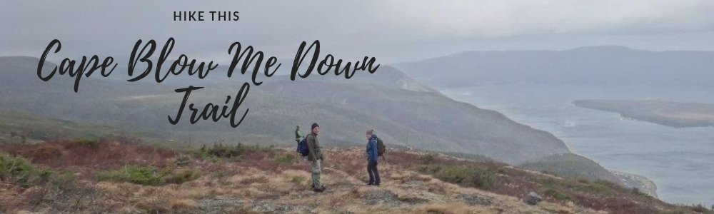
One of the best trails in the Bay of Islands area, the Cape Blow Me Down Trail (formerly Copper mine to Cape) is always worth the climb – summer, fall, winter or spring! This trail take you up about 650m to the summit (Cape Blow Me Down) where you have an expansive 360 degree view of the entire Bay of Islands and on a clear day, the North Arm Hills and City of Corner Brook.
Quick Hike Stats
- Total Distance: 8.4km (includes all lookouts and a few laps of the summit)
- Total Elevation Gain: 657m
- Total Time: 3 hours, 56 min (of which only 40mins was coming down! I poke along the up hill part, going to all the lookouts, taking pictures and generally enjoying being in the woods.)
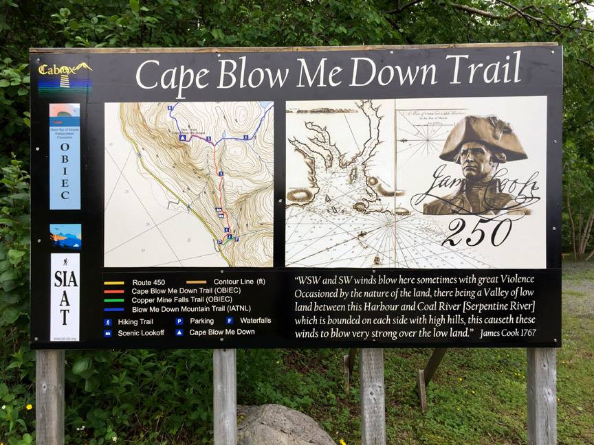
Trail Map
The map above is not intended for navigational purposes. Mapped using Terra Map Pro – Canada Version 5.4 (iOS App) and imported to Google Maps.
I love to hike this trail in the off season and the following story and images are from a hike in mid-february!
Blue bird day + Light winds + High of -4C = Great Day for a Hike!
With that weather forecast, how could I not be outside today?! Thankfully my “real job” working for Wild Women Expeditions has flexible hours, so I can accommodate the weather. I try to play outside when its nice out or snowing in epic proportions and work if the weather is stupid cold, wet or its dark outside. Read more about NL Weather here.
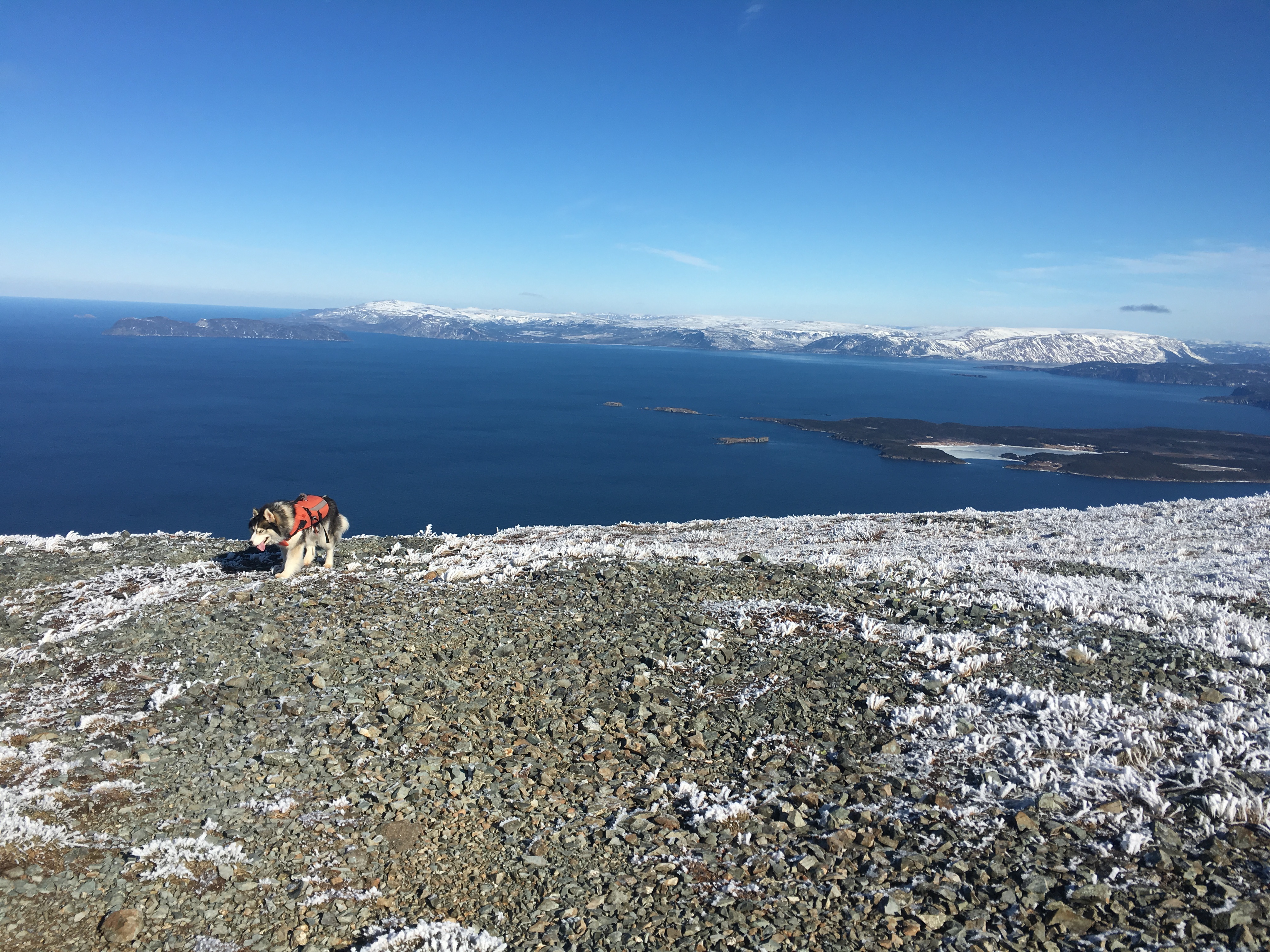
Today’s adventure took me out the Bay of Islands to the Cape Blow Me Down Trail because I knew the views would be worth the climb. With all my outdoors gear, snowshoes, cameras and adventure dog in tow, I punched in the trailhead, 9am sharp!
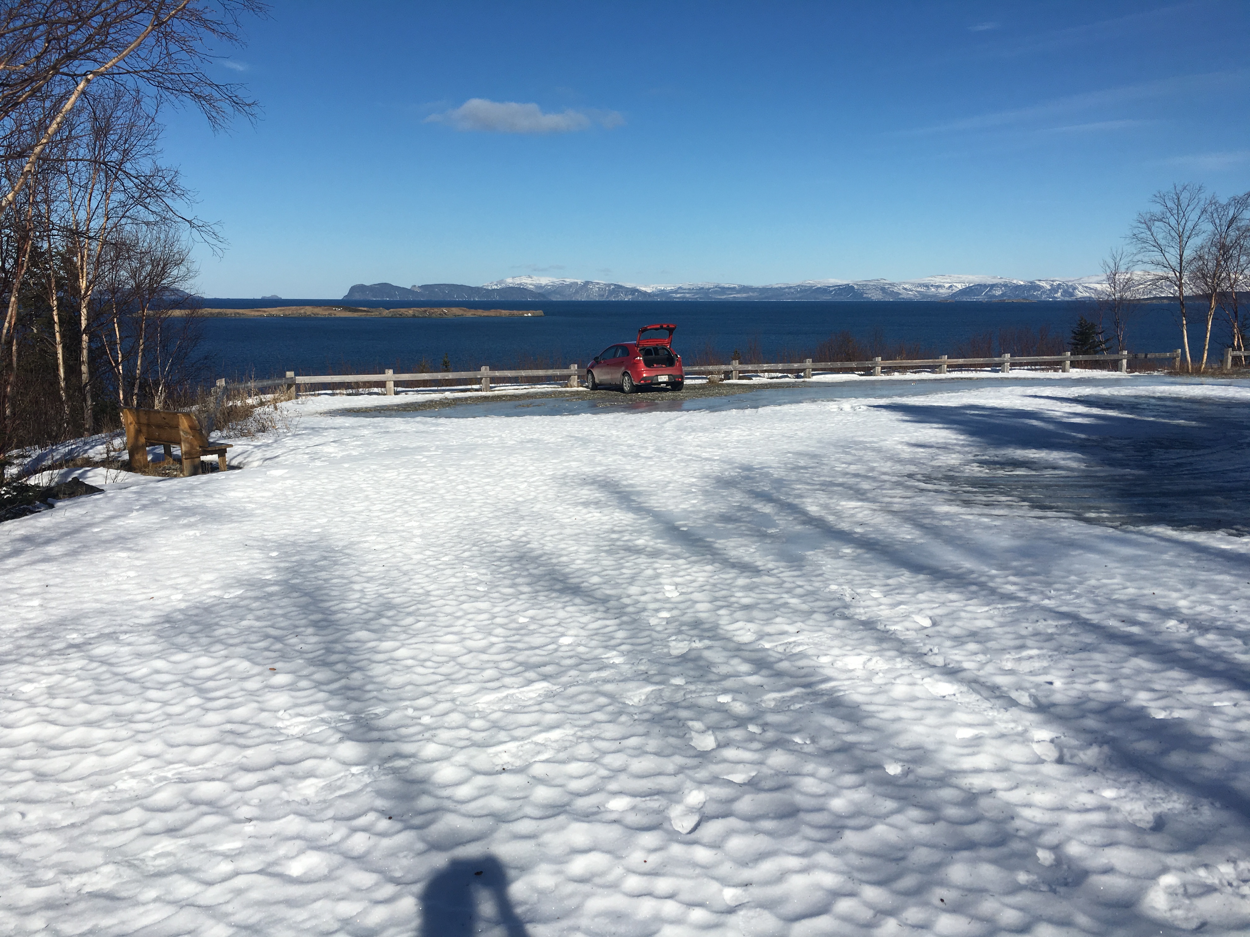
I was able to get my little Kia Rio into the parking lot (thanks to whom ever went first!) with a bit of shovelling and a bit of determination. The plow pile at the end is all I had to get over, the rest of the parking lot is sheer ice or totally bare. I geared up and began the climb.
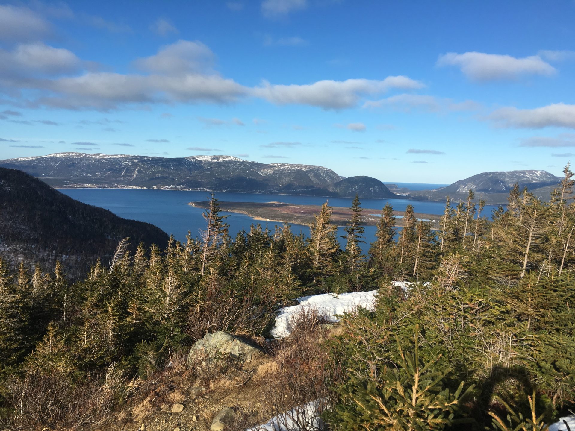
The trail is still totally snow covered (read: icy crusty snow), so it was essential to wear snowshoes for traction and follow the flagging tape through the trees. The only tracks to follow were the moose prints and they don’t always lead where you want to go. Views of the islands were awesome at each lookout.
The ropes are still in good condition along the trail. I noticed perhaps 5-6 blowdowns that you have to skirt around and a couple widow makers (fallen trees that are still hanging, ready to fall) that folks should be mindful of.
As I broke the tree line, there was less snow and more ice. The tread of the trail (in most places) is the lowest spot, so after the melt last week, the trail tread has become filled with ice. Snowshoes with good crampons are key.
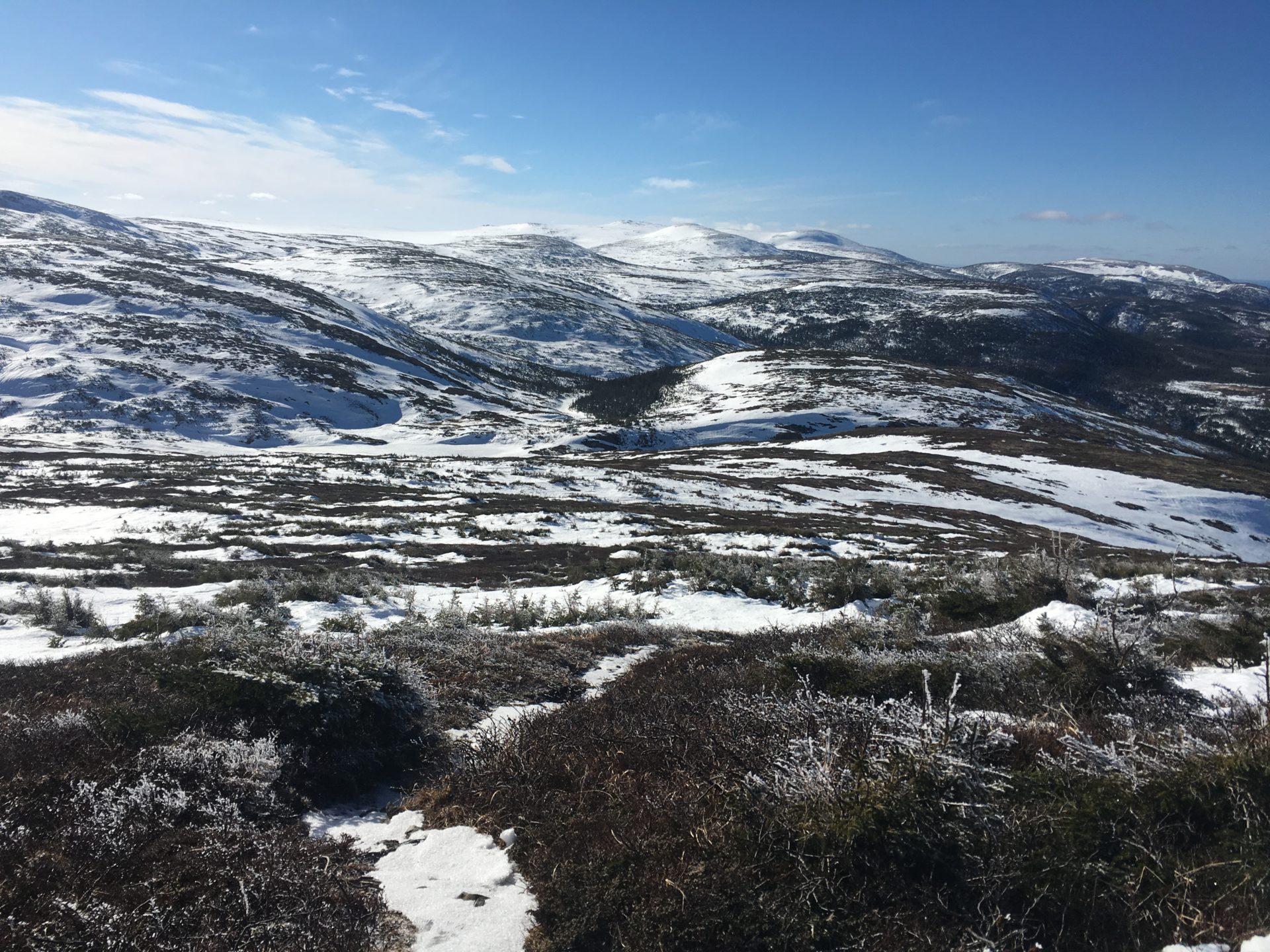
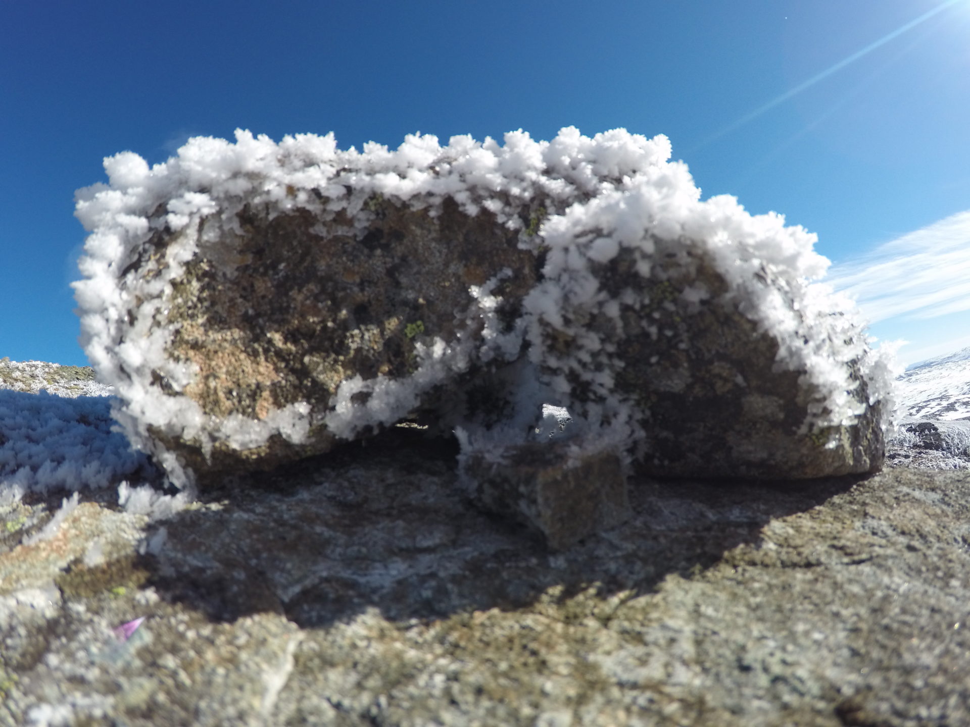
Staying left, I picked my way up to the summit and was surprised to see that the “snow” was actually hoar frost. “The formation of hoar frost is similar to the formation of dew with the difference that the temperature of the object on which the hoar frost forms is well below 0°C, whereas this is not the case with dew. Hoar frost crystals often form intitially on the tips of plants or other objects.” (weather online.co.uk) Hoar frost is very beautiful, but also super dangerous where snowpack and avalanches are concerned.
The views from the summit are the best in the area. You can see all the islands in the bay, the North Arm Hills, the Lewis Hills, and all the way back to Corner Brook. It is so incredibly beautiful up there! Year round, this trail never ceases to amaze me, there is always something new to see or experience in the Blow Me Downs.
I took my pictures and videos then sat for a snack and enjoyed the sunshine at the summit. Memories of previous hikes floating though my memory; my first time up here in 2009 with IATNL when we got lost in the fog and soaked in our tents, the time we attempted in winds gusting to 80km/hr and getting blown around like rag dogs, the overnight trips in July watching the sunset at 9pm, and the summit approach from the east in 2014 after 3 days in the Blow Me Downs only to help day hikers find the geocaches!
So many great times up on this mountain for better or worse. The vastness of the landscape and the harshness of the weather makes me really appreciate days like today, blue bird sky with light winds and views as far as the eye can see.
It’s the extremes. This is it. This is why I love Newfoundland.
I packed up and began to make my way down. Watching my feet, trying not to slip. But I slipped and slid, tearing my pants on the way down…why did I take off my snowshoes?! Once off the barrens (and with the snowshoes back on) I made quick work of my descent, racing Bubbles all the way down.
Back at the car, I loaded up the gear and tired dog, took a deep breath of fresh, bay air and headed back to Corner Brook and to work. Until next time Blow Me Downs!